Uncovering the story of Drake’s Leat with Ron Smith and Plym Links Magazine
Plymouth’s water supply - Uncovering the story of Drake’s Leat
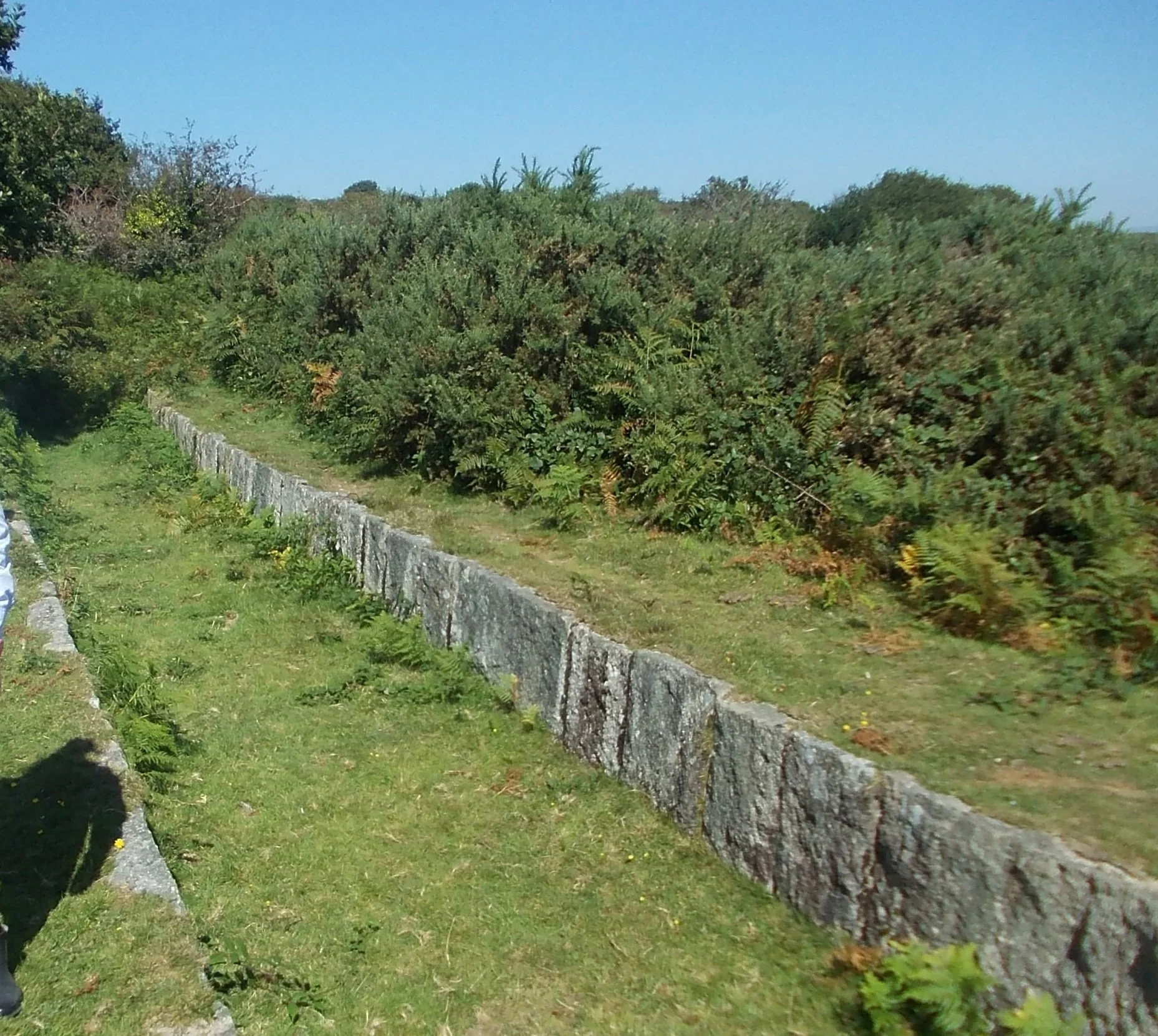
Drake’s Leat. Credit Ron Smith and Plym Links Magazine
A stream tumbles along taking the line of least resistance down the hillside. Put in a weir, take a channel sideways across the hillside, cut at a carefully-engineered gentle descent, leading the water to where you need to use it – you have a LEAT. The Plymouth Leat, known as Drake’s Leat, is a major example.
Where can an expanding settlement get its water from? A long leat, bringing copious fresh water from the nice clean countryside upstream, was an ingenious solution; well done, Sir Francis Drake and his consortium of local businessmen. This was not necessarily purely philanthropic; in Plymouth, the route was carefully chosen to supply water power to mills owned by Drake and his friends (though the legend of Sir Francis riding a white horse alongside the onrushing water as it made its way 17½ miles into Plymouth is unlikely to be true).
16th century to present day
The first sod was cut in December 1591, three years after the defeat of the Spanish Armada, and a team of 35 workmen completed the leat just four months later. The leat started in the stream-fed valley at the head of the Meavy River, from which Burrator Reservoir takes its water. Dry since the reservoir was completed in 1890, the leat can be visited as it emerges from the foot of the dam.
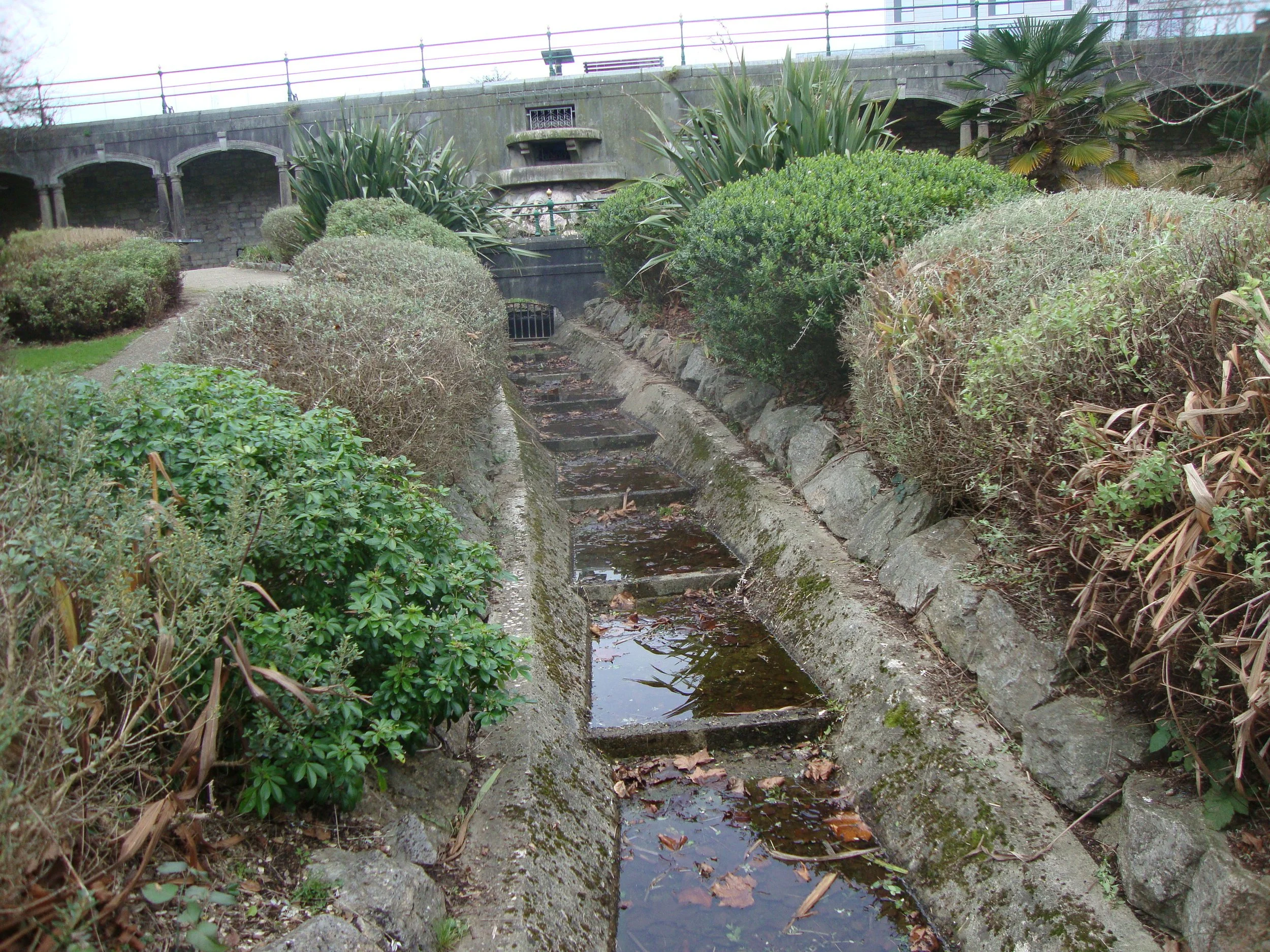
Leat rebuilt through Drake’s Place. Credit Ron Smith and Plym Links Magazine
At the beginning of WWII, it was feared that the reservoir dam might be bombed and the leat was completely refurbished, ready for emergency use. What is seen today is its state after these works, though inevitably a bit broken down in places, and largely disappeared under Plymouth’s suburban development. It can readily be seen from many places higher up on the moor. In particular, it may be followed downstream from Yelverton. As one follows the old tramway track, the leat is immediately below on the left. Above Clearbrook, it breaks free of all other routes, taking a long semicircle to contour round the swell of the moor. This is a pleasant walk until the leat disappears again to enter the grounds of the new Mayflower Water Treatment Works roughly opposite the Dartmoor Diner. In Roborough, it is a back garden feature in Leat Walk. Its detail all the way to the reservoir at North Hill has been carefully recorded, but is not readily accessible.
Drake’s Place
Here the leat did its first proper job for Drake; it powered a flour mill. The remains were demolished in 1891 to allow the present lovely garden to be created. Above them find the reservoir, built in the 1820s. A section of the leat has been rebuilt, running in steps down through the middle of the garden. On the back corner of the colonnade separating garden and reservoir, a Conduit House has been rebuilt. This was one of 27 along the line of the leat as it went through Plymouth, allowing folk to collect their drinking water. This one was originally built in Old Town St in 1754, then shifted here in 1891 to join the colonnade.
The latest re-discovery

Major works are in progress along Armada Way. Drake’s Leat ran through, but was covered up by rubble from buildings demolished after the German bombing blitz of WWII. Now a short section of the original leat has been revealed and studied. It is unlikely to be exposed to public view, but it can be hoped that it will be more carefully covered up this time.
Ron Smith, history writer at Plym Links Magazine
Ron Smith’s original article April 2025 reproduced here thanks to Ron and Plym Links Magazine.